
Google Earth Engine(GEE)——墨累全球潮汐湿地变化 v1 (1999-2019) 数据集
The Murray Global Tidal Wetland Change Dataset contains maps of the global extent of tidal wetlands and their change. The maps were developed from a t...

Google Earth Engine(GEE)——全球洪水数据库 v1 (2000-2018年)
全球洪水数据库包含 2000-2018 年间发生的 913 次洪水事件的范围和时间分布图。有关详细信息,请参阅 相关期刊文章。洪水事件是从达特茅斯洪水观测站收集的 ,用于收集 MODIS 图像。选定的 913 个事件是那些使用 Terra 和 Aqua MODIS 传感器的 12,719 个场景成功...
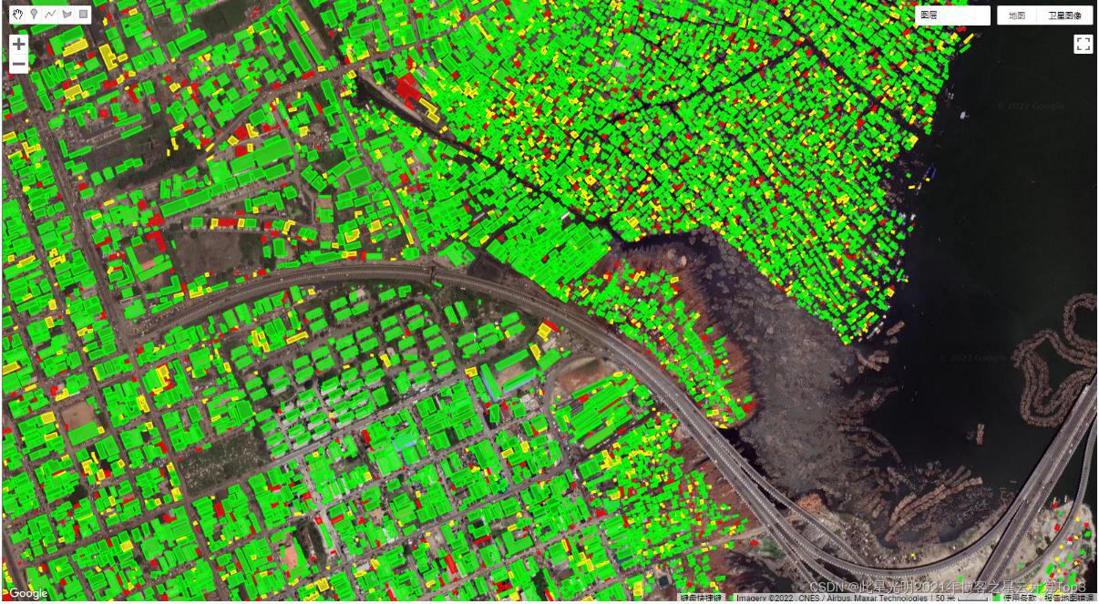
Google Earth Engine(GEE)——全球建筑物矢量图免费下载Open Buildings V1 Polygons
之前我们已经介绍过了关于微软全球建筑物提取的矢量图。全球建筑物提取数据集(免费下载):微软/GlobalMLBuildingFootprints_此星光明2021年博客之星云计算Top3的博客-CSDN博客_建筑物提取数据集数据介绍:这个大规模的开放数据集包括从高分辨率的50厘米卫星图像中得出的建筑...
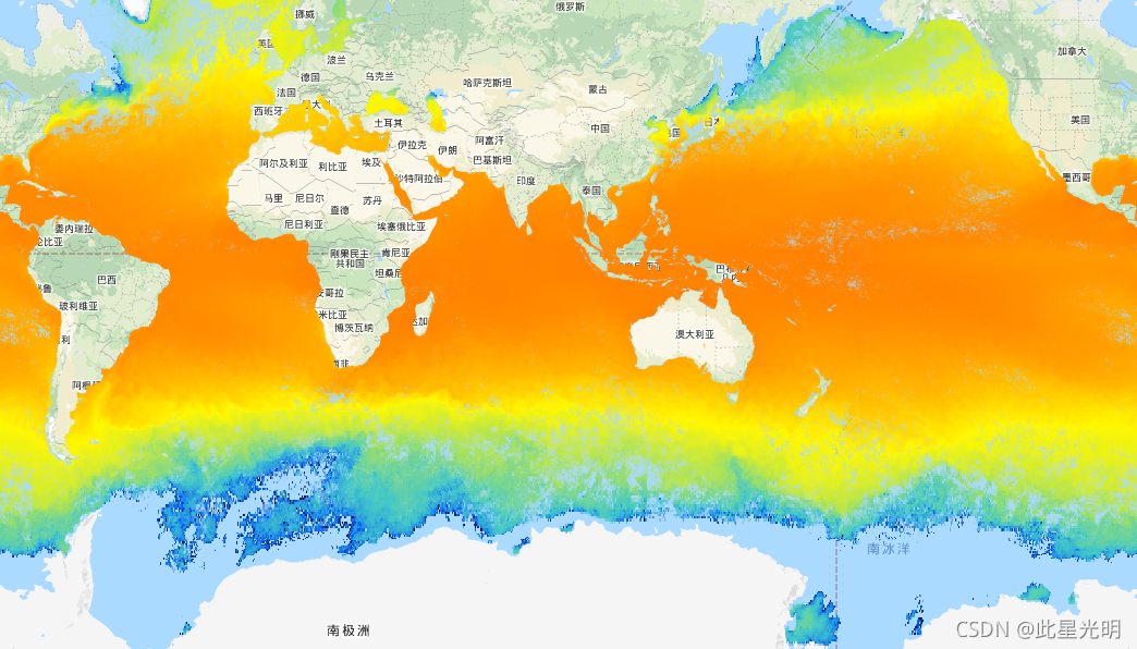
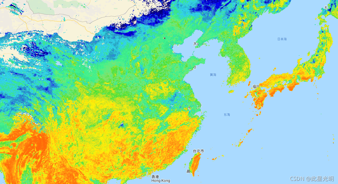
Google Earth Engine ——GCOM-C 进行长期和持续的海洋表面温度数据集(JAXA/GCOM-C/L3/OCEAN/SST/V1)
This product is the temperature of sea surface.A newer version JAXA/GCOM-C/L3/OCEAN/SST/V2 is also available for this dataset which uses this algorith...
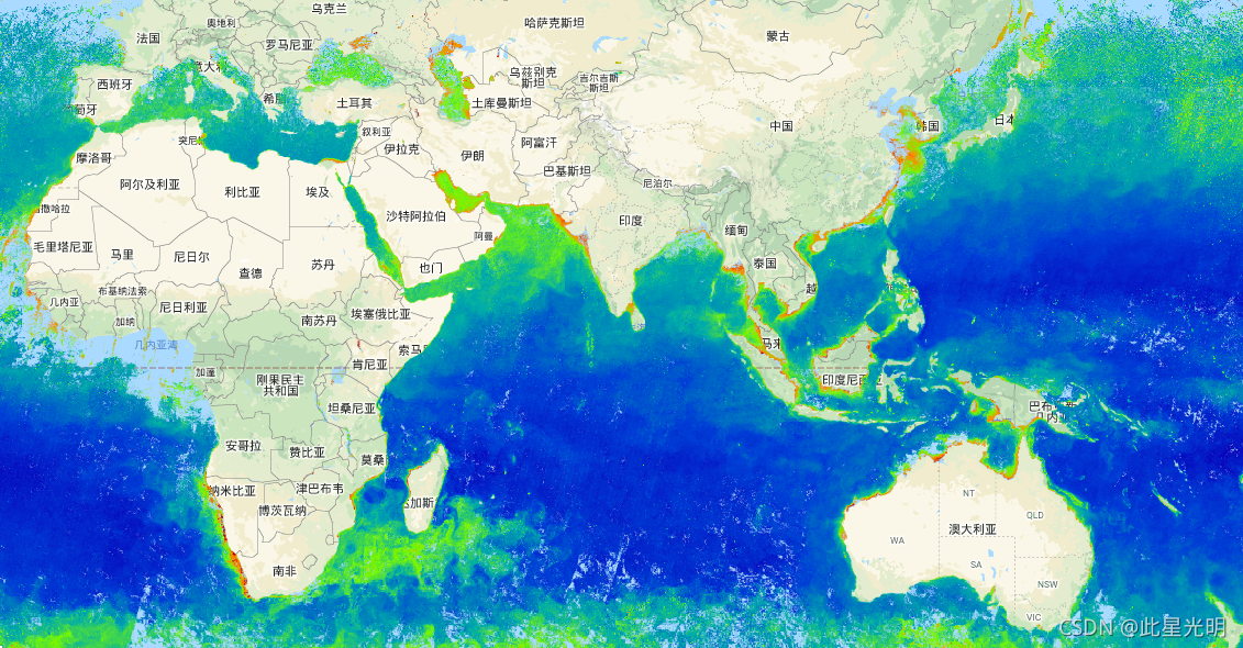
Google Earth Engine ——GCOM-C 进行长期和持续的海表层浮游植物中绿色色素(叶绿素-a)的浓度。数据集(JAXA/GCOM-C/L3/OCEAN/CHLA/V1)
该乘积是海表层浮游植物中光合色素(叶绿素-a)的浓度。更新版本的 JAXA/GCOM-C/L3/OCEAN/CHLA/V2 也可用于此数据集,该数据集使用此算法进行处理。GCOM-C 进行长期和持续的全球观测和数据收集,以阐明辐射收支和碳循环波动背后的机制,从而对未来温度上升做出准确预测。同时,与有...
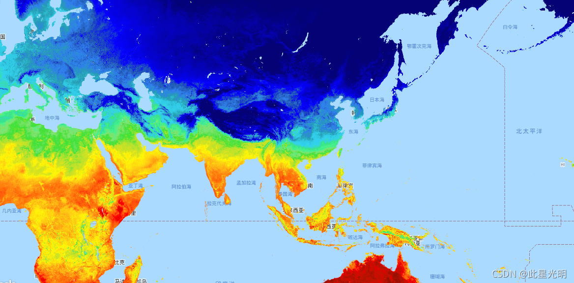
Google Earth Engine ——GCOM-C 进行长期和持续的全球陆地地表温度数据集(JAXA/GCOM-C/L3/LAND/LST/V1)
本产品是陆地表面的温度。 更新版本的 JAXA/GCOM-C/L3/LAND/LST/V2也可用于此数据集,该数据集使用此算法进行处理。 GCOM-C 进行长期和持续的全球观测和数据收集,以阐明辐射收支和碳循环波动背后的机制,从而对未来温度上升做出准确预测。同时,与有气候数值模型的研究机构合作,有助...
Google Earth Engine ——GCOM-C 进行长期和持续的全球叶面积指数数据集(JAXA/GCOM-C/L3/LAND/LAI/V1)
This product is the sum of the one-sided green leaf area per unit ground area.A newer version JAXA/GCOM-C/L3/LAND/LAI/V2 is also available for this da...
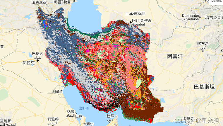
Google Earth Engine ——2017-2018年伊朗土地覆盖/土地利用数据集KNTU/LiDARLab/IranLandCover/V1
The Iran-wide land cover map was generated by processing Sentinel imagery within the Google Earth Engine Cloud platform. For this purpose, over 2,500 ...
Google Earth Engine ——逐小时捕鱼强度GFW/GFF/V1/fishing_hours数据集
Fishing effort, measured in hours of inferred fishing activity. Each asset is the effort for a given flag state and day, with one band for the fishing...
Google Earth Engine ——全球渔船信息GFW/GFF/V1/vessel_hours数据集
Fishing vessel presence, measured in hours per square km. Each asset is the vessel presence for a given flag state and day, with one band for the pres...
本页面内关键词为智能算法引擎基于机器学习所生成,如有任何问题,可在页面下方点击"联系我们"与我们沟通。
google您可能感兴趣
- google firebase
- google platform
- google规范
- google插件
- google代码
- google脚本
- google api接口
- google方法
- google gemini
- google项目
- google engine
- google earth
- google数据集
- google数据
- google play
- google chrome
- google分辨率
- google开源
- google应用
- google浏览器
- google分析
- google网站
- google搜索
- google影像
- google地图
- google landsat
- google ai
- google谷歌
- google guava
- google下载